Introduction
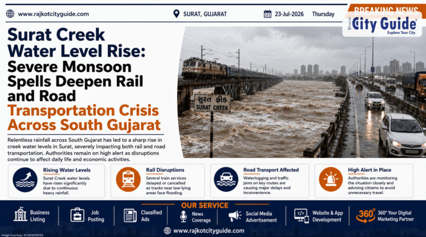
The arrival of the monsoon season in western India brings vital agricultural relief, but excessive precipitation frequently pushes urban and rural infrastructure to its ultimate breaking point. Over the past forty-eight hours, South Gujarat has witnessed an unprecedented downpour, leading to catastrophic flash floods, massive infrastructure blockages, and deep societal disruptions. Among the most concerning developments reported by state administrative authorities is the sudden and severe Surat Creek Water Level Rise, particularly concerning the Mithikhadi creek system in Surat. As low-lying urban sectors grapple with the rapid inflow of overflowing creek water, local emergency services have been placed on the highest level of alert.
- Introduction
- What is the Surat Creek Water Level Rise?
- Why This News is Important
- Background Information and Urban Context
- Key Highlights of the South Gujarat Rain Crisis
- Detailed Explanation of the Crisis
- Logistical and Public Health Impacts
- Expert Insights on Urban Hydrology and Infrastructure
- Administrative Challenges and Limitations
- Future Outlook
- Frequently Asked Questions (FAQs)
- Conclusion
This environmental and infrastructural emergency extends far beyond the municipal borders of Surat. In the adjoining Narmada district, a major temporary road diversion has been completely washed away by raging floodwaters, isolating seven local villages from the mainland and cutting off essential supply lines. Simultaneously, the Western Railway network has suffered severe disruptions along the highly critical Ahmedabad-Mumbai corridor. Seven major long-distance trains have been cancelled, leaving thousands of commuters stranded at regional railway hubs like Navsari. Compounding the material damage is a direct loss of human life; emergency recovery teams extracted a body from the overflowing waters of Surat’s Mithikhadi, underscoring the lethal nature of the ongoing downpour.
Understanding the systematic causes behind urban creek flooding and broader infrastructural vulnerabilities is essential for regional travelers, residents, and disaster management teams. This comprehensive, deep-dive article provides a highly detailed analysis of the ongoing rain crisis in Gujarat. It covers why these weather events are intensifying, how transportation networks are failing, and what immediate steps are required to protect vulnerable local communities.
What is the Surat Creek Water Level Rise?
The term Surat Creek Water Level Rise refers to the dangerous elevation of water volumes within the natural narrow coastal inlets and drainage channels—locally known as ‘khadis’ or creeks—that cut through the highly populated urban areas of Surat. The city of Surat relies heavily on a network of secondary drainage channels, such as Mithikhadi, Kakra Khadi, and Bhedwad Khadi, to route surface runoff away from residential sectors and guide it safely toward the Tapi River and the Arabian Sea.
When an extraordinary amount of localized rain falls within a condensed timeframe, these narrow creeks are overwhelmed by massive volumes of urban stormwater. A severe Surat Creek Water Level Rise occurs when the inflow of water completely outpaces the carrying capacity of the creek beds. This condition is frequently worsened by the presence of urban solid waste, silt accumulations, and institutional bottlenecks that restrict smooth water movement. As a direct consequence, the creek banks overflow, pushing feet of contaminated, fast-moving water directly into adjacent high-density residential colonies and industrial spaces.
Why This News is Important
This news is highly important because it reveals the structural vulnerabilities of one of India’s fastest-growing economic hubs and industrial corridors. Surat is globally recognized for its massive diamond polishing houses and expansive textile manufacturing hubs. When a major climate event causes a severe water level rise in the city’s primary drainage channels, the entire economic engine slows down. Daily wage laborers cannot travel to factory floors, industrial raw materials face water damage, and global supply chains experience sudden delays.
Furthermore, the simultaneous disruption of the Western Railway line highlights how deeply interconnected regional transit networks are. The cancellation of seven premium trains along the Ahmedabad-Mumbai route creates an immediate logistical nightmare across two industrialized states. When major tracking routes fail, regional economic activity takes a hit. The tragic loss of life discovered in the overflowing Mithikhadi also serves as a somber reminder that urban flooding is not merely an inconvenience—it represents an immediate, high-priority public safety hazard that requires swift administrative intervention.
Background Information and Urban Context
To comprehend the scale of the ongoing crisis, one must look closely at the geographic and urban planning history of South Gujarat. Surat is a low-lying coastal city that sits near the mouth of the Tapi River. Over the last three decades, the city has undergone unprecedented population growth and rapid concrete development. While the Surat Municipal Corporation (SMC) has won national accolades for its proactive waste management and post-1994 plague cleanup strategies, the management of urban creeks during the peak monsoon season remains an complex engineering challenge.
During high-intensity rain spells, the problem is compounded by tidal variations. If heavy rainfall coincides with a high tide in the Arabian Sea, the Tapi River experiences a backwater effect. This prevents the urban creeks from draining naturally into the river system. Instead of flowing outward, the water pushes back into the city, accelerating the rise of water levels in areas like Mithikhadi.
Additionally, districts like Narmada and Navsari features rugged terrains and numerous seasonal river tributaries. The infrastructure in these districts, including temporary bridge diversions built near active construction sites, is highly susceptible to high-energy river currents. When these rural connections collapse alongside urban creek failures, the entire South Gujarat administrative zone faces a simultaneous crisis.
Key Highlights of the South Gujarat Rain Crisis
The current monsoon emergency is defined by several critical infrastructural collapses and emergency responses across the state:
- Mithikhadi Casualty: Emergency response teams successfully recovered a deceased individual from the overflowing waters of Surat’s Mithikhadi creek during peak flood levels.
- Rail Network Paralysis: The Western Railway branch officially cancelled seven major trains operating along the highly congested Ahmedabad-Mumbai industrial corridor.
- Passenger Stranding: Hundreds of long-distance rail passengers found themselves completely stranded at the Navsari railway station due to waterlogging over track beds.
- Narmada Village Isolation: A major temporary road diversion was completely washed away by fast currents in the Narmada district, leaving seven interior villages entirely cut off.
- Red and Orange Alerts: The India Meteorological Department (IMD) has issued continuous heavy rainfall alerts across multiple South Gujarat districts, warning of further water level rises.
Detailed Explanation of the Crisis
The ongoing environmental emergency across South Gujarat developed rapidly following a massive intensification of a low-pressure monsoon system over the Arabian Sea. This system dropped intense, non-stop rainfall across the coastal and tribal belts of the state. In Surat, the localized rain instantly accumulated across concrete surfaces, draining directly into the narrow Mithikhadi channel. Within hours, the water level reached dangerous thresholds, overflowing the banks and flooding streets in surrounding residential blocks with several feet of mud-laden water. It was during these intense hours of flooding that local rescue teams spotted and recovered a body from the creek, highlighting the immense dangers of venturing out near open urban drainage channels during high-intensity storms.
Simultaneously, the heavy rain caused severe damage to the regional transportation infrastructure. Further south in the Navsari district, heavy rainfall submerged sections of the main railway tracks. Because operating heavy locomotives over flooded tracks poses immense derailment and electrical risks, the Western Railway management had no choice but to issue immediate cancellation orders for seven key trains running between Ahmedabad and Mumbai. The sudden cancellations resulted in crowded platforms at Navsari and surrounding stations, leaving families, business travelers, and daily commuters stranded without immediate alternative transport.
Meanwhile, the rural infrastructure in the Narmada district suffered an equally harsh blow. A temporary road diversion, which had been set up to facilitate local travel while permanent bridge upgrades were being constructed, could not withstand the sudden hydrostatic pressure of the swelling local river. The structure washed away completely. With the destruction of this link, seven distinct villages lost their only functional road connection to major medical, administrative, and commercial centers, forcing district authorities to coordinate emergency food and medical airlifts.
Logistical and Public Health Impacts
The cascading effects of urban creek flooding and transportation halts impact multiple segments of society:
1. Hardships for Daily Commuters and Travelers
The cancellation of seven primary trains along the Ahmedabad-Mumbai line directly disrupts the schedules of business professionals, students traveling to universities, and families managing medical emergencies. When train tracks are submerged at crucial junctions like Navsari, alternative road routes quickly become clogged with traffic, leaving travelers stuck for hours in hazardous conditions.
2. Isolation of Rural Communities
For the residents of the seven isolated villages in Narmada, the loss of the road diversion is an immediate risk to life. Pregnant women, elderly citizens, and individuals experiencing acute illnesses cannot reach regional hospitals. Furthermore, daily supply chains for items like fresh milk, clean cooking fuel, and essential groceries are completely cut off until engineers can stabilize the crossing.
3. Public Health Hazards in Submerged Urban Areas
When an urban creek like Mithikhadi overflows, it carries industrial effluents, street garbage, and untreated sewage into residential doorsteps. This exposure creates an immediate breeding ground for dangerous waterborne pathogens. In the days following a water level rise, municipal health teams face the daunting task of preventing outbreaks of leptospirosis, cholera, and vector-borne illnesses like dengue and malaria.
Expert Insights on Urban Hydrology and Infrastructure
Urban planning experts and hydraulic engineers consistently state that India’s older industrial cities must radically redesign their drainage networks to cope with changing monsoon patterns. Traditional drainage systems are built around historical averages. However, modern weather patterns frequently feature hyper-localized cloudburst-like events, dropping immense volumes of water over a city in a fraction of the time.
Hydrologists note that simply concrete-lining creek channels is no longer a complete solution. When creeks are lined with concrete, it increases water velocity, which can worsen downstream flooding. Experts advocate for the creation of open urban wetlands, sponge-city conceptual models, and automated, real-time telemetry systems along key channels like Mithikhadi. These systems can provide early warnings to residents living on the banks well before a critical water level rise occurs, saving lives and protecting movable assets.
Administrative Challenges and Limitations
Managing a multi-district monsoon disaster presents severe operational challenges for local administrations and the National Disaster Response Force (NDRF):
- Encroachment Along Creek Banks: Over the years, informal housing and commercial extensions have cropped up along the natural boundaries of Surat’s creeks. These structural bottlenecks reduce the physical width of channels like Mithikhadi, making it difficult for heavy machinery to enter and clear silt during emergencies.
- Execution Under Active Rainfall: Rebuilding a washed-out road diversion in Narmada or repairing submerged railway tracks at Navsari while heavy rain continues to fall is dangerous and slow work. High river currents prevent laborers from safely laying stone bases or stabilizing banks.
- Coordination of Massive Crowds: Managing thousands of frustrated, stranded passengers at major regional railway stations requires extensive police deployment to maintain order, manage temporary food supplies, and distribute accurate transit updates.
Future Outlook
Over the next few days, the immediate priority for the Gujarat government is the stabilization of transit corridors. The Western Railway is monitoring water levels at Navsari closely using track-mounted sensors, ready to resume limited train operations the moment track beds clear. Simultaneously, state engineers are waiting for water velocities in Narmada to drop so they can deploy heavy boulder tipping trucks to establish a basic, passable link for the seven isolated villages.
Looking ahead to the coming years, the Surat Municipal Corporation is expected to accelerate its long-term creek widening projects and build permanent retaining walls along the Mithikhadi channel. As climate variance shifts rainfall patterns, investing in deep-channel dredging and upgrading rural bridge designs from temporary diversions to elevated, all-weather concrete structures will be critical to safeguarding the population and economy of South Gujarat.
Frequently Asked Questions (FAQs)
1. What caused the recent Surat Creek Water Level Rise?
The water level rise was caused by non-stop, hyper-localized heavy rainfall across South Gujarat, which overwhelmed the natural carrying and drainage capacity of urban channels like the Mithikhadi creek.
2. Which specific train route has been impacted by the heavy rain?
The highly critical Ahmedabad-Mumbai railway corridor managed by the Western Railway has faced severe disruptions, resulting in the cancellation of seven major long-distance trains.
3. Why are rail passengers stranded specifically at Navsari?
Navsari experienced intense localized downpours that directly submerged the railway track beds. Because running heavy trains over flooded tracks presents severe safety risks, trains were halted, leaving passengers stranded at the station.
4. How did the rain affect rural communities in the Narmada district?
A key temporary road diversion was completely washed away by high-velocity river currents. This structural failure left seven interior villages entirely isolated from major road networks and essential services.
5. What tragedy was reported near the Mithikhadi creek in Surat?
During peak flood levels, emergency response and recovery teams discovered and extracted the body of an individual from the overflowing waters of the Mithikhadi creek.
6. What is a “backwater effect” in urban creek flooding?
A backwater effect occurs when high tides in the sea or high levels in a main river (like the Tapi) prevent secondary creeks from draining outward. This causes the water to push backward into the city streets.
7. How are local authorities responding to the isolated villages in Narmada?
Local administrative teams are monitoring weather conditions to safely dispatch emergency supplies and are preparing to reconstruct a stable crossing as soon as river velocities drop to safe levels.
Conclusion
The ongoing rain emergency across South Gujarat serves as a stark reminder of the immense challenges posed by intense monsoon patterns on regional infrastructure. The severe Surat Creek Water Level Rise, the tragic casualty at Mithikhadi, the isolation of seven rural villages in Narmada, and the halting of transit along the vital Ahmedabad-Mumbai railway corridor highlight the need for resilient infrastructure. While emergency relief teams work tirelessly to clear tracks and restore basic connectivity, long-term success requires robust urban planning. By focusing on deep-channel dredging, removing creek encroachments, and building durable, all-weather rural bridges, Gujarat can better protect its communities and secure its economic hubs against future monsoon crises.