Introduction
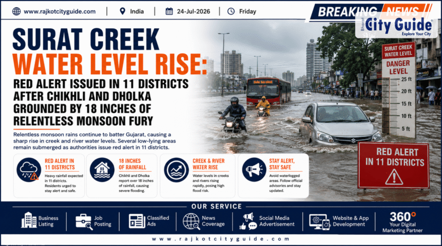
The monsoon season has taken an aggressive turn across Western India, unleashing an unprecedented volume of precipitation that has thrown normal life completely out of gear. Heavy rains have hammered South and Central Gujarat, pushing regional water management and urban drainage networks past their limits. Localities like Chikhli and Dholka have recorded up to 18 inches of rainfall in a devastating 24-hour window, leading to flash floods and massive waterlogging. As rivers swell and soils become completely saturated, the primary focus has turned toward the escalating industrial and residential crisis in the state’s economic core: the Surat Creek Water Level Rise.
- Introduction
- What is the Surat Creek Water Level Rise?
- Why This News is Important
- Background Information and Regional Context
- Key Highlights of the Monsoon Deluge GujaratFirst
- Detailed Breakdown of the Flood Impact
- Why Managing Creek Levels is a Unique Challenge
- How the Deluge Impacts Different Groups of People
- Industry Perspective on Urban Flood Control
- Challenges Facing Rescue Operations
- Future Outlook
- Frequently Asked Questions (FAQs)
- Conclusion GujaratFirst
With four out of the five major tidal creeks running through Surat expanding rapidly, the city is on the brink of a severe creek flood. In response to this dangerous escalation, the India Meteorological Department (IMD) has issued a strict Red Alert for 11 districts. Recognizing the immediate danger to human life, the state government has declared a complete holiday for schools and colleges across 19 affected districts
This news is critical not just for immediate safety, but also for its broader impacts on regional infrastructure, daily travel, and economic supply chains. This comprehensive report covers the ground realities of the current flood emergency, the unique risks associated with Surat’s rising creeks, and what to expect in the coming days.
What is the Surat Creek Water Level Rise?
The Surat Creek Water Level Rise describes the dangerous swelling of natural tidal streams—locally known as khadis—that cut through the urban fabric of Surat. The city’s geography features an intricate network of these creeks, including the Mithi, Kakara, Bhedwad, Bhatena, and Simada creeks. These waterways serve as the primary natural channels for draining rainwater away from residential and industrial zones out into the Tapi River and the Arabian Sea.
When severe rain events dump double-digit rainfall over the city and its upstream catchments, these narrow channels face an overwhelming volume of water. The risk multiplies significantly when heavy surface runoff coincides with high ocean tides. The high tide effectively pushes seawater inland, blocking the creeks from discharging their water.
As a result, the water level rises sharply, breaches the embankments, and flows backward into low-lying residential pockets like Limbayat, Udhana, and Sarthana. Unlike a standard river flood, creek flooding traps water directly within dense urban centers, turning streets into deep, slow-draining pools.
Why This News is Important
This developing situation demands urgent attention due to its widespread humanitarian and economic consequences. Surat is a massive manufacturing hub, housing India’s primary diamond processing sector and an expansive textile industry.
When major creeks overflow, floodwaters quickly submerge industrial power looms, raw material storehouses, and vital transit roads. Prolonged waterlogging forces manufacturing units to shut down, stalls freight logistics, and inflicts heavy daily financial losses on businesses and daily-wage laborers.
Furthermore, the scale of this monsoon event poses immediate safety risks to thousands of citizens living in low-lying developments. The activation of a Red Alert across 11 districts and the suspension of classes in 19 districts highlight the state’s urgent focus on preventing casualties. Emergency teams must navigate highly congested urban areas to conduct evacuations, making timely public information essential to avoid panic.
Background Information and Regional Context
The current crisis stems from a series of highly active weather systems stalling directly over Western India. While the early stages of the monsoon brought standard seasonal showers, the mid-to-late July window saw a massive surge in moisture drawn from the Arabian Sea. This led to intense cloudburst-style events across several parts of the state.
| District / Taluka | Rainfall Accumulation (24-Hour Peak) | Primary Operational Impact |
|---|---|---|
| Mehmedabad (Kheda) | 19.96 Inches (507 mm) | Record rural and urban inundation |
| Dholka (Ahmedabad) | 18.62 Inches (473 mm) | Widespread highway closures |
| Chikhli (Navsari) | 17.76 Inches (451 mm) | Severe residential flooding |
| Umarpada (Surat) | 17.05 Inches (433 mm) | Direct feed into regional creek systems |
As these historic downpours saturated the soil, the excess water quickly flowed down into the state’s low-lying coastal plains. Because Surat sits at the receiving end of several regional drainage patterns, it faced a double blow: intense local downpours combined with massive inflows from surrounding, elevated districts. This volume quickly overwhelmed local drainage lines, culminating in the critical creek conditions seen today.
Key Highlights of the Monsoon Deluge GujaratFirst
- Historic Rainfall Spikes: Dholka and Chikhli faced severe flooding after logging roughly 18 inches of rain within 24 hours.
- Surat Creek Water Level Rise: Four out of five major urban creeks have breached or are approaching their danger thresholds.
- Widespread Red Alerts: The IMD placed 11 vulnerable districts under a strict Red Alert for exceptionally heavy rainfall.
- Educational Closures: 19 districts ordered all schools and colleges to remain closed to keep students off flooded roads.
- Emergency Deployments: National Disaster Response Force (NDRF) and State Disaster Response Force (SDRF) teams have deployed heavy-duty rescue boats and dewatering assets across South Gujarat.
- Infrastructure Stress: Dozens of low-lying causeways and underpasses are closed to traffic to prevent vehicles from being swept away.
Detailed Breakdown of the Flood Impact
The Crisis Across Chikhli and Dholka
In Chikhli and Dholka, the sheer intensity of the 18-inch downpour left local administrations with very little reaction time. Water rushed into ground-floor residences, commercial shops, and local government offices. Roads transformed into swift currents, submerging parked vehicles and cutting off links to neighboring villages. Emergency responders worked late into the night, using inflatable rafts to pull stranded residents from vulnerable structures and bring them to safety.
The Rising Waters in Surat YouTube
In Surat, the situation is being monitored hourly by municipal engineers. The Mithi and Bhedwad creeks have risen steadily, putting high-density neighborhoods on high alert.
Surat Municipal Corporation (SMC) has positioned heavy-duty dewatering pumps at critical choke points like Bhatena and Limbayat to push encroaching waters back into the channels. However, as long as upstream regions continue to discharge water into the system, lowering the water level remains an uphill battle.
Why Managing Creek Levels is a Unique Challenge
Controlling an urban creek flood involves complex challenges that differ significantly from standard river management:
- Enclosed Urban Channels: Unlike wide river plains, urban creeks are closely framed by residential walls, industrial concrete, and paved roads. When they overflow, the water immediately impacts homes and businesses.
- Tidal Backwash: High tides act like a temporary dam at the mouth of the creek. No matter how fast drainage pumps work, the water cannot exit into the ocean until the tide recedes.
- High Siltation Levels: Urban runoff carries mud, trash, and industrial debris that settles at the bottom of the creeks. This gradual buildup reduces the channel’s depth and limits the total volume of water it can safely carry.
- Encroached Floodplains: Over time, rapid urban expansion has narrowed natural seasonal floodplains. This leaves less room for excess water to spread out safely, forcing it directly into city streets.
How the Deluge Impacts Different Groups of People
Daily Citizens and Commuters
For local residents, the flooding turns simple daily routines into hazardous situations. Flooded roads, stalled cars, and hidden open potholes make traveling highly dangerous. Power distribution grids in deeply flooded pockets are often turned off as a safety measure, leaving families to deal with both waterlogging and power outages.
Students and Educational Institutions
With 19 districts enforcing mandatory closures for schools and colleges, students face a sudden shift in their academic calendars. While these actions are essential to keep children off dangerous, flooded roads, extended closures require institutions to adjust their schedules later in the term.
Industrial Units and Supply Chain Logistics
The industrial clusters in Udhana and Pandesara face significant logistical hurdles. Submerged access roads prevent workers from safely reaching their shifts, while damp conditions threaten raw fabrics and sensitive machinery. Delays in moving freight to major state ports also create supply chain challenges for businesses.
Industry Perspective on Urban Flood Control
Urban planning experts emphasize that as intense rainfall events become more common, cities must adapt their infrastructure to handle larger volumes of water over shorter periods. Standard drainage designs based on older weather data are increasingly overwhelmed by modern cloudbursts.
To address these challenges, the state government recently approved an initial allocation of ₹500 crore specifically for creek development and structural improvement works in Surat. Analysts note that long-term solutions must focus on widening narrow creek banks, building resilient retaining walls, and installing automated tidal gates to prevent ocean water from pushing back into the city during high tides.
Challenges Facing Rescue Operations
Emergency response crews face several difficulties on the ground:
- Submerged Debris: Floating trash and hidden underwater obstacles can damage the propulsion units of rescue boats, slowing down evacuations.
- Highly Congested Areas: Surat’s densely populated residential lanes leave little room to maneuver large emergency equipment.
- Contaminated Water: Wading through mixed floodwater and urban runoff exposes rescue workers and residents to skin infections and waterborne illnesses.
- Persistent Weather Blocks: Continuous heavy downpours limit visibility and prevent support helicopters from operating safely, leaving ground crews to handle the response.
Future Outlook
The immediate outlook requires continued caution. Regional weather models indicate that the active monsoon systems will bring more rain across South and Central Gujarat over the next 24 to 48 hours. The risk of additional urban flooding remains elevated as long as the ground stays fully saturated.
Once the active rain bands move toward the Arabian Sea, municipal teams will focus on pumping out remaining water pools, clearing mud from blocked roads, and restoring damaged power grids. Public health teams will also need to conduct disinfection drives to prevent seasonal disease outbreaks.
Frequently Asked Questions (FAQs)
What causes the Surat Creek Water Level Rise during heavy rains?
The rise happens when intense local rainfall and upstream runoff overwhelm natural tidal creeks. The situation worsens during high ocean tides, which block the creeks from discharging water out to sea, causing it to back up into local streets.
Which areas in Surat are most vulnerable to creek flooding?
Low-lying residential and industrial sectors like Limbayat, Udhana, Pandesara, Sarthana, and Bhatena face the highest risk when regional creek embankments overflow.
Why did the state order school and college closures? GujaratFirst
The government declared mandatory holidays across 19 districts as a safety measure to prevent students and staff from getting stranded or injured on deeply flooded roads.
How much rain fell in Chikhli and Dholka during this storm?
Both Chikhli and Dholka received roughly 18 inches of rain within a 24-hour window, causing severe flash flooding and widespread road closures.
What is the government doing to provide a long-term solution?
The state government has allocated ₹500 crore for creek widening, embankment construction, and drainage improvements in Surat to prevent recurring urban floods.
How can I stay updated on local creek levels and evacuation orders?
Residents should monitor official updates from the Surat Municipal Corporation (SMC), follow verified local news channels, and keep emergency helpline numbers handy.
What health precautions should be taken after floodwaters recede?
Avoid wading through stagnant water, drink boiled or filtered water, use mosquito repellents to prevent dengue or malaria, and report any signs of waterborne illness to local health centers immediately.
Conclusion GujaratFirst
The ongoing Surat Creek Water Level Rise and the extreme 18-inch downpours in Chikhli and Dholka highlight the challenges of managing severe monsoon events in rapidly growing urban areas. The combination of heavy rains, full soil saturation, and high ocean tides creates unique difficulties for local drainage systems, directly impacting residents and industries alike.
With Red Alerts still active across 11 districts, staying safe must remain the top priority. Residents should follow official guidance, avoid unnecessary travel through flooded areas, and cooperate with emergency teams working to protect vulnerable neighborhoods. The planned long-term investments in creek infrastructure will be crucial to building a more resilient city that can safely handle future monsoon seasons.