Introduction
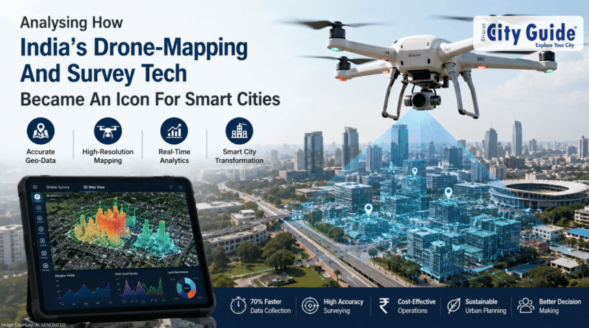
India’s rapid urbanization has created major challenges related to infrastructure planning, traffic management, land records, environmental monitoring, and public service delivery. As cities expand and populations grow, traditional surveying and urban planning methods are increasingly struggling to keep pace with modern development demands. To address these challenges, India has increasingly adopted Drone-Mapping Technology and advanced digital survey systems as important tools for smart city development.
- Introduction
- Understanding Drone-Mapping Technology
- Rise of Smart Cities in India
- Smart Cities Mission
- Why Drone-Mapping Technology Became Important
- Faster Data Collection
- Applications of Drone-Mapping Technology in Smart Cities
- Land and Property Mapping
- Role of GIS and Digital Mapping Systems
- What Is GIS?
- Government Initiatives Supporting Drone Technology
- Drone Rules and Policy Reforms
- Impact of Drone-Mapping Technology on Urban Planning
- Improved City Design
- Drone Technology and Real Estate Development
- Construction Monitoring
- Artificial Intelligence and Drone Mapping
- Automated Data Analysis
- Economic Impact of Drone-Mapping Technology
- Growth of Drone Industry
- Challenges Facing Drone-Mapping Adoption
- Privacy Concerns
- Importance of Data Security in Drone Systems
- Protecting Infrastructure Data
- Drone Technology in Disaster Response
- Flood Monitoring
- Future of Drone-Mapping Technology in India
- Integration With Smart Infrastructure
- Role of Education and Skill Development
- Technical Education Programs
- Frequently Asked Questions (FAQs)
- Conclusion
Drone-Mapping Technology has transformed how Indian cities collect geographic data, monitor infrastructure, plan transportation systems, manage land resources, and improve governance efficiency. Drones equipped with cameras, GPS systems, LiDAR sensors, and artificial intelligence tools can capture highly accurate aerial images and real-time data faster and more efficiently than many traditional methods.
India’s Smart Cities Mission and digital governance initiatives have accelerated the adoption of drone-based surveying across urban and semi-urban regions. Drone technology is now used for:
- Land surveys
- Property mapping
- Infrastructure monitoring
- Traffic analysis
- Environmental management
- Disaster assessment
The rise of Drone-Mapping Technology reflects India’s broader digital transformation and modernization goals. It combines geographic information systems (GIS), artificial intelligence, data analytics, and automation to improve urban planning and administrative decision-making.
This article explores how Drone-Mapping Technology became an important part of India’s smart city ecosystem, its applications, government initiatives, economic impact, challenges, and future potential in urban development.
Understanding Drone-Mapping Technology
Drone-Mapping Technology uses unmanned aerial vehicles (UAVs) equipped with sensors and cameras to capture geographic and spatial data from the air.
The collected data is processed into:
- Digital maps
- 3D models
- Geographic surveys
- Infrastructure analysis reports
Drone mapping supports:
- Urban planning
- Construction monitoring
- Land management
- Environmental studies
Modern drones may include:
- GPS systems
- Thermal cameras
- LiDAR sensors
- Artificial intelligence software
These technologies improve mapping accuracy and efficiency.
Rise of Smart Cities in India
India’s smart city movement created demand for advanced digital infrastructure.
Smart Cities Mission
The Smart Cities Mission was launched to improve:
- Urban infrastructure
- Public services
- Sustainability
- Technology-driven governance
Rapid Urbanization
Indian cities are expanding rapidly due to:
- Population growth
- Industrial development
- Migration
Need for Better Urban Planning
Traditional mapping methods often struggled with:
- Slow data collection
- Manual errors
- Limited scalability
Drone-based systems provided faster and more detailed urban data.
Why Drone-Mapping Technology Became Important
Drone technology offers several advantages over traditional survey methods.
Faster Data Collection
Drones can survey large areas in much less time.
High Accuracy
Advanced sensors provide highly detailed mapping information.
Cost Efficiency
Drone surveys may reduce:
- Labor costs
- Manual surveying expenses
- Operational delays
Real-Time Monitoring
Authorities can monitor:
- Construction projects
- Traffic conditions
- Urban expansion
in real time.
Applications of Drone-Mapping Technology in Smart Cities
Drone technology is now integrated into multiple urban functions.
Land and Property Mapping
Drones help create:
- Accurate land records
- Property boundaries
- Digital cadastral maps
Infrastructure Development
Urban planners use drones for:
- Road construction
- Bridge inspection
- Utility monitoring
Traffic and Transportation Management
Drone surveys assist in:
- Traffic analysis
- Road planning
- Congestion monitoring
Environmental Monitoring
Drones support monitoring of:
- Pollution levels
- Green cover
- Water bodies
Disaster Management
Drone systems assist during:
- Floods
- Earthquakes
- Fire emergencies
by providing rapid aerial assessment.
Role of GIS and Digital Mapping Systems
Drone mapping works closely with GIS technology.
What Is GIS?
Geographic Information Systems (GIS) help store, analyze, and visualize spatial data.
Combining Drones and GIS
Drone data can be integrated into:
- Urban planning systems
- Smart infrastructure platforms
- Digital governance dashboards
Data-Driven Decision Making
Authorities use GIS-based analysis for:
- Resource allocation
- Infrastructure planning
- Environmental management
Government Initiatives Supporting Drone Technology
India has introduced several initiatives encouraging drone adoption.
Drone Rules and Policy Reforms
India simplified drone regulations to encourage:
- Innovation
- Commercial applications
- Technology investment
Digital India and Smart Governance
Digital governance programs increased demand for:
- Real-time urban data
- Geographic intelligence
- Smart infrastructure systems
SVAMITVA Scheme
The SVAMITVA initiative uses drone mapping for:
- Rural property surveys
- Digital land ownership records
Infrastructure Modernization
Government agencies increasingly use drones in:
- Railways
- Highways
- Urban projects
Impact of Drone-Mapping Technology on Urban Planning
Urban planning has become more data-driven.
Improved City Design
Accurate mapping helps optimize:
- Land use
- Road networks
- Public infrastructure
Better Resource Management
Cities can manage:
- Water systems
- Waste management
- Utility services
more efficiently.
Reduced Planning Errors
High-quality spatial data minimizes mapping inaccuracies.
Faster Project Execution
Construction and development projects benefit from quicker surveys and inspections.
Drone Technology and Real Estate Development
Real estate sectors increasingly use drone mapping.
Construction Monitoring
Developers track:
- Project progress
- Structural development
- Site management
Property Visualization
3D aerial mapping improves:
- Property presentations
- Investment planning
- Urban design visualization
Land Verification
Drone surveys help verify:
- Ownership boundaries
- Encroachment issues
- Site conditions
Artificial Intelligence and Drone Mapping
AI is enhancing the capabilities of drone systems.
Automated Data Analysis
AI helps process:
- Aerial images
- Survey data
- Infrastructure conditions
Predictive Urban Planning
Smart systems may predict:
- Traffic growth
- Urban expansion
- Infrastructure demand
Object Recognition Systems
AI can identify:
- Buildings
- Roads
- Utility networks
from aerial imagery.
Economic Impact of Drone-Mapping Technology
Drone adoption contributes to economic modernization.
Growth of Drone Industry
India’s drone sector is expanding through:
- Startups
- Manufacturing
- Software development
Employment Opportunities
Drone industries create jobs in:
- Engineering
- Data analysis
- Survey operations
- GIS technology
Infrastructure Efficiency
Accurate surveys reduce:
- Delays
- Project costs
- Planning inefficiencies
Challenges Facing Drone-Mapping Adoption
Despite rapid growth, challenges remain.
Privacy Concerns
Aerial data collection raises concerns regarding:
- Surveillance
- Data misuse
- Citizen privacy
Cybersecurity Risks
Drone systems require protection against:
- Hacking
- Data theft
- Unauthorized access
Technical Skill Gaps
Drone operations require trained professionals.
Regulatory Compliance
Drone usage must follow:
- Airspace rules
- Safety regulations
- Data management standards
Importance of Data Security in Drone Systems
Digital mapping systems collect sensitive geographic information.
Protecting Infrastructure Data
Authorities must secure:
- Critical infrastructure maps
- Urban planning databases
- Geographic intelligence systems
Responsible Data Usage
Ethical data handling is essential for maintaining public trust.
Secure Cloud Systems
Large drone datasets often require secure digital storage platforms.
Drone Technology in Disaster Response
Drones have become valuable tools during emergencies.
Flood Monitoring
Aerial mapping helps identify:
- Flood-affected zones
- Water movement
- Rescue routes
Fire and Earthquake Assessment
Emergency teams use drones for:
- Damage analysis
- Infrastructure inspection
- Rescue planning
Faster Emergency Response
Real-time imagery improves disaster coordination and public safety operations.
Future of Drone-Mapping Technology in India
India’s drone ecosystem is expected to grow rapidly.
Integration With Smart Infrastructure
Future smart cities may increasingly use:
- Autonomous drones
- AI-based urban monitoring
- Real-time mapping systems
Expansion Beyond Major Cities
Drone mapping may expand into:
- Rural governance
- Agriculture
- Environmental conservation
Indigenous Drone Manufacturing
India is encouraging domestic drone production and technological self-reliance.
5G and Smart Connectivity
Faster communication networks may improve:
- Real-time drone operations
- Data transmission
- Smart-city integration
Role of Education and Skill Development
Drone technology requires specialized workforce training.
Technical Education Programs
Institutions increasingly offer courses in:
- UAV operations
- GIS mapping
- Drone engineering
Industry Certification
Professional certifications improve:
- Safety standards
- Operational quality
- Employment opportunities
Research and Innovation
Universities and startups contribute to:
- Drone software
- AI integration
- Advanced mapping systems
Frequently Asked Questions (FAQs)
What is Drone-Mapping Technology?
Drone-Mapping Technology uses drones to capture aerial geographic and survey data.
Why is drone mapping important for smart cities?
It improves urban planning, infrastructure management, and real-time monitoring.
What is GIS in drone mapping?
GIS is a digital system used to analyze and visualize geographic data.
How do drones help urban planning?
They provide accurate aerial surveys for roads, buildings, and infrastructure projects.
What are the risks of drone technology?
Major risks include:
- Privacy concerns
- Cybersecurity threats
- Regulatory challenges
What is the SVAMITVA scheme?
It is an Indian government initiative using drones for rural property mapping.
How does AI improve drone mapping?
AI helps automate image analysis and improve infrastructure monitoring.
Conclusion
Drone-Mapping Technology has become a powerful symbol of India’s smart city transformation and digital infrastructure modernization. By combining drones, GIS systems, artificial intelligence, and real-time data analytics, Indian cities are improving urban planning, infrastructure development, environmental monitoring, and governance efficiency.
The increasing use of drone-based surveys across land mapping, transportation planning, disaster management, and construction monitoring reflects India’s broader commitment to technology-driven development. Government initiatives such as the Smart Cities Mission, SVAMITVA scheme, and digital governance reforms have accelerated drone adoption across both urban and rural regions.
Although challenges related to privacy, cybersecurity, regulation, and technical training remain important, Drone-Mapping Technology is expected to play an even larger role in India’s future urban ecosystem. As smart infrastructure expands and digital governance evolves, drones will continue shaping how Indian cities are planned, managed, and developed in the coming decades.