Introduction
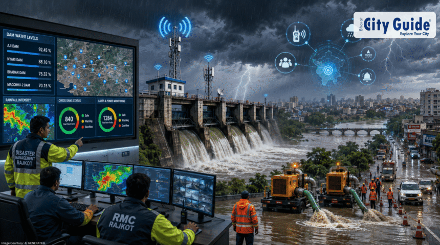
As climatic shifts make monsoon seasons across South Asia increasingly unpredictable, local administrations must transition from reactive rescue setups to predictive disaster defense models. For the city of Rajkot and the surrounding Saurashtra region, heavy downpours can transform local rivers, lakes, and reservoirs from critical water sources into serious public safety risks within a matter of hours. Recognizing these evolving meteorological patterns, the Rajkot district authorities and municipal departments have finalized a comprehensive seasonal disaster mitigation roadmap. This updated approach focuses heavily on implementing fail-safe communications and mechanical water evacuation systems across vulnerable territories. Modern disaster management control center coordinating monsoon response workflows. Source: The Indian Express
- Introduction
- What is Rajkot Flood Preparedness?
- Why This News is Important
- Background Information
- Key Highlights
- Detailed Explanation of the Safety Initiatives
- Strategic Value and System Importance
- How It Impacts the Community
- Expert Insights on Modern Flood Management
- Challenges and Operational Limitations
- Future Outlook
- Frequently Asked Questions (FAQs)
- Conclusion
The cornerstone of this season’s strategy is ensuring uncompromised communication channels during severe weather outbreaks. Historically, excessive rainfall and lightning strikes have disrupted cellular networks and knocked out traditional telephone lines, leaving critical reservoir operators isolated from central administration rooms. To eliminate this operational blind spot, high-frequency independent wireless radio networks have been deployed directly across regional dam hubs. Coupled with the systematic tracking of over a thousand lakes and hundreds of local check dams, this infrastructure forms a resilient protective shield. Backed by high-capacity mechanical drainage pumps standing ready to clear urban lowlands, the updated framework for Rajkot Flood Preparedness sets a strong blueprint for community protection.
What is Rajkot Flood Preparedness?
Rajkot Flood Preparedness refers to the coordinated, multi-departmental emergency management framework executed by the Rajkot Municipal Corporation (RMC), the District Collectorate, and the Irrigation Department. The core goal of this collaborative operation is to protect human lives, prevent livestock losses, and secure critical public infrastructure during extreme cloudburst events or prolonged monsoon depressions. The framework covers a wide range of actions, including real-time hydrological mapping, structural stability testing of reservoirs, cleaning major urban drainage channels, and setting up pre-planned evacuation routes for low-lying settlements.
Rather than looking at flood mitigation as a simple rescue operation that begins after streets submerge, this comprehensive safety strategy views flood defense as a continuous, tech-driven operation. This approach combines real-time data from hundreds of scattered water bodies into a centralized command dashboard. By monitoring the exact water levels of regional catchments, the system allows engineers to make highly controlled, incremental water releases from dams. This prevents sudden, massive water surges downstream that could quickly overwhelm local villages and urban neighborhoods.
Why This News is Important
The rollout of this updated safety framework is highly critical because it directly tackles the most dangerous variable in disaster management: the failure of communications. When a major reservoir fills up unexpectedly at midnight, a delay of even fifteen minutes in alerting downstream communities can result in devastating property damage or loss of life. By mounting dedicated, independent wireless radio systems at crucial dam control stations, the local government ensures that dam operators can coordinate with central emergency offices regardless of how badly local commercial mobile towers or fiber networks are damaged by storm winds.
Additionally, this massive deployment shows a clear understanding of regional geography. Saurashtra’s landscape is filled with thousands of micro-storage structures, including check dams and community ponds, built over the years to help conserve water in this historically arid zone. While these structures are highly beneficial for farming, they can become structural hazards if multiple micro-dams break or overflow at the same time during a cloudburst. Keeping a close eye on these minor water bodies while keeping 30 high-capacity dewatering pumps ready to clear out urban flash floods shows a well-balanced approach to managing both rural and city environments.
Background Information
The geographic and hydrological layout of Rajkot makes it uniquely vulnerable to sudden, intense instances of flash flooding. The city is positioned on an elevated semi-arid plateau, surrounded by clay-heavy soil layers that naturally slow down how quickly rainwater can soak into the ground. Major rivers like the Aji and Nyari flow directly through or right alongside the city limits, fed by a complex network of upstream channels. When the region experiences intense rain, these dry riverbeds can quickly turn into fast-moving torrents, threatening nearby residential zones.
Over the past few decades, urban growth has paved over natural drainage pathways, meaning heavy rain can quickly lead to localized urban flooding. Past monsoon seasons have shown that whenever the major sluice gates of the Aji or Nyari dams must be opened wide to handle sudden water inflows, low-lying neighborhoods like Popatpara, Jungleshwar, and areas near the Lalpari lake face rapid water accumulation. Recognizing these historical vulnerabilities, the city’s disaster response teams have moved away from outdated manual warning methods, shifting toward automated tracking and robust communication systems.
Key Highlights
- Fail-Safe Wireless Radio Deployment: Major regional dams are now equipped with independent wireless communication sets to ensure constant contact during severe network outages.
- Massive Water Body Tracking: Disaster teams are actively tracking water levels across 1,284 local ponds and lakes alongside 840 rural check dams.
- High-Volume Dewatering Pumps: 30 high-capacity mechanical dewatering pumps have been positioned at key urban locations to quickly clear water out of flooded lowlands.
- Central Command Control: A round-the-clock central control room has been established to log real-time water levels and coordinate emergency resources.
- Pre-monsoon Drainage Desilting: Critical stormwater mains and natural water channels across the city have undergone extensive cleanup to maximize flow capacity.
- Rapid Evacuation Protocols: Safe shelter structures and designated emergency response teams have been mapped out near vulnerable riverbanks for rapid deployment.
Detailed Explanation of the Safety Initiatives
1. Fail-Safe Communications via Wireless Networks
The decision to install dedicated wireless communication systems at regional reservoirs directly resolves a major problem faced during past monsoon emergencies. During severe downpours, regular telecom towers often lose power or suffer structural damage, breaking lines of communication between dam engineers and city administrators. By introducing private radio frequencies that run on independent backup power systems, the irrigation department can broadcast real-time water levels, inflow data, and structural updates constantly, ensuring downstream areas get timely warnings.
2. Monitoring the Micro-Hydrology Network
While large reservoirs like the Aji, Nyari, and Bhadar dams get plenty of public attention, the real breakthrough in this safety plan is the systematic monitoring of smaller water bodies. The administration has mapped out a network of 1,284 lakes and ponds alongside 840 rural check dams across the district. Local field officers, revenue inspectors, and village administrators use a structured reporting system to update central control rooms on how much capacity these smaller structures have left, preventing unexpected flash floods caused by multiple small dams overflowing at once.
3. Urban Dewatering Systems
To manage flooding within the city streets, the Rajkot Municipal Corporation has deployed a fleet of 30 high-capacity dewatering pumps. These heavy-duty industrial pumps are designed to move thousands of liters of muddy water per minute out of flooded areas. They are strategically stationed near historical trouble spots, such as low-lying railway underpasses, dense inner-city neighborhoods, and underdesigned road crossings, ensuring that flash floods can be cleared out before water seeps into local homes and businesses.
Strategic Value and System Importance
The updated structural adjustments provide several clear benefits for regional safety management:
- Guarantees Communication Continuity: Using private wireless radio networks ensures that essential safety data moves smoothly between teams, even during the worst weather conditions.
- Enables Proactive Evacuations: Getting precise, early updates on water inflows allows administrators to execute calm, organized evacuations of low-lying neighborhoods hours before floodwaters arrive, avoiding chaotic midnight rescues.
- Reduces Urban Economic Losses: Deploying heavy-duty dewatering pumps rapidly prevents prolonged street flooding, protecting local businesses, electrical substations, and underground infrastructure from water damage.
- Improves Resource Allocation: Having an accurate overview of water levels across 1,284 lakes and 840 check dams allows emergency teams to send rescue boats, earthmovers, and sandbags exactly where they are needed most.
How It Impacts the Community
1. Daily Citizens and Commuters
For residents living in low-lying pockets of Rajkot, these structured updates bring immense peace of mind. Automated text alerts and organized dam water releases mean families can secure their belongings and move to safety calmly. Commuters also benefit, as quick-acting dewatering pumps mean major roads, bridges, and underpasses clear up faster after heavy rains, minimizing traffic gridlock.
2. Farmers and Rural Neighborhoods
For the agricultural communities surrounding Rajkot, keeping a close eye on the 840 check dams provides essential security. Farmers get timely updates on whether upstream structures can handle incoming water, helping them protect their crops, secure livestock, and prevent soil erosion along riverbanks.
3. Industrial Zones and Investors
The industrial areas around Rajkot, famous for manufacturing auto components and machine tools, rely heavily on stable logistics. Preventing long-term flooding around manufacturing hubs ensures that supply chains remain undisrupted, protecting raw materials and assuring investors that the city’s infrastructure can handle severe weather events.
Expert Insights on Modern Flood Management
Disaster management experts frequently highlight that successful flood mitigation relies on three core stages: Preparedness, Response, and Recovery. Modern flood management has moved past simply building high concrete walls along riverbanks, focusing instead on dynamic space management and real-time communication.
Hydrological engineers note that installing independent wireless loops on dams is an industry best practice for handling severe weather events. This matches the globally recognized Incident Command System (ICS) framework, which requires backup communication lines between field teams and emergency headquarters. By keeping these channels open, city planners can balance reservoir levels perfectly, keeping enough water on hand for the dry season while ensuring there is plenty of space left to catch sudden storm runoffs safely.
Challenges and Operational Limitations
Even with high-capacity equipment and modern wireless networks, managing severe monsoons comes with real challenges:
- The Challenge of Plastic Waste: A major issue for the 30 dewatering pumps is the presence of plastic bags and household trash in the stormwater drains. This debris can quickly clog pump intakes, requiring maintenance teams to manually clear the grates under dangerous conditions.
- Rapid Urban Growth: The fast pace of building construction across Rajkot creates more paved surfaces and fewer open fields. This increases the speed and volume of surface runoff, putting extra pressure on the city’s older drainage channels.
- Unpredictable Weather Events: While tracking 1,284 lakes is highly effective for normal monsoons, sudden cloudbursts that drop immense amounts of rain in under an hour can still overwhelm local drainage systems before gates can be adjusted.
Future Outlook
The future of Rajkot Flood Preparedness points toward fully automated, sensor-driven water management systems. Over the coming years, the manual monitoring of lakes and check dams will likely be replaced by solar-powered ultrasonic water level sensors. These devices can beam live water metrics directly to central databases using satellite IoT networks, cutting out the need for manual check-ins entirely.
Furthermore, the city is exploring “Sponge City” design concepts for future urban expansions. By building public parks with recessed retention ponds, using permeable paving materials that let water soak into the ground, and preserving natural wetlands, Rajkot aims to reduce its reliance on mechanical dewatering pumps, building a city layout that naturally absorbs heavy rainfall.
Frequently Asked Questions (FAQs)
1. Why are independent wireless sets being installed on Rajkot’s dams?
Wireless sets provide a private, reliable radio communication network that works independently of commercial cell towers, ensuring dam engineers can coordinate water releases even during severe power cuts or network outages.
2. How many local water bodies are being tracked under the Rajkot Flood Preparedness plan?
The district administration is systematically tracking water levels across 1,284 local lakes and ponds along with 840 rural check dams to prevent unexpected flash floods.
3. What is the role of the 30 high-capacity dewatering pumps?
These heavy-duty industrial pumps are strategically positioned near low-lying urban pockets and underpasses to quickly clear out accumulated rainwater, preventing flash floods from reaching homes and businesses.
4. How does monitoring check dams help ordinary citizens?
Tracking the 840 check dams gives authorities early warnings about structural issues or sudden overflows upstream, allowing them to alert downstream villages and neighborhoods hours before water reaches dangerous levels.
5. Which local departments coordinate the Rajkot Flood Preparedness operations?
The initiative is managed through close collaboration between the Rajkot Municipal Corporation (RMC), the District Collectorate’s Disaster Management cell, and the State Irrigation Department.
6. What should citizens do when dam sluice gates are scheduled to open?
Residents living near riverbanks should monitor official government alerts, avoid crossing low-lying bridges, and follow evacuation guidelines to move to designated safe shelters calmly if instructed.
7. How do clogged stormwater drains affect the city’s dewatering pumps?
Street litter and plastic waste can block pump intake valves, reducing how much water they can move. Citizens can help by keeping trash out of open drains, ensuring the drainage system runs at full capacity during heavy rains.
Conclusion
Ultimately, the updated upgrades to the Rajkot Flood Preparedness framework show a highly practical approach to handling severe monsoon seasons. By installing independent wireless networks on key dams, tracking a massive web of 1,284 lakes and 840 check dams, and keeping 30 high-capacity dewatering pumps ready for action, local authorities have built a robust system to protect the community. While we cannot control the severity of seasonal storms, investing in reliable communication tools and powerful drainage gear ensures that the city can weather intense downpours safely, keeping its citizens protected and its vital infrastructure secure.