Introduction
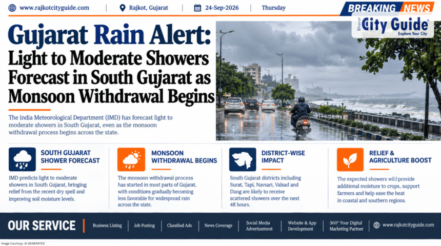
Weather patterns across Western India are undergoing a crucial seasonal transition. According to the latest bulletins issued by the India Meteorological Department (IMD), a official Gujarat Rain Alert remains active for select southern districts, even as the Southwest Monsoon initiates its formal retreat from the northwestern borders of the state.
- Introduction
- What is Gujarat Rain Alert?
- Why This News is Important
- Background Information
- Key Highlights
- Detailed Explanation of the Weather Event
- Benefits and Importance of Current Weather Changes
- How It Impacts Different Sectors
- Expert Insights and Meteorological Perspective
- Challenges and Limitations
- Future Outlook
- Frequently Asked Questions (FAQs)
- Conclusion
While light to moderate rain and thundershowers are expected to linger across isolated pockets of South Gujarat—including Surat, Navsari, Valsad, Dang, and Tapi—drier weather is settling over Saurashtra, North Gujarat, and the Kutch region. Statistically, the state as a whole has recorded an overall seasonal rainfall deficit of approximately 8% compared to long-term averages. However, regional disparities remain severe: while parts of South Gujarat have seen heavy rainfall, districts in Kutch and Western Saurashtra face shortages ranging up to 50% or more.
Understanding these shifting weather patterns is vital for farmers planning crop harvesting, urban municipalities managing drainage, and citizens preparing for late-monsoon humidity.
What is Gujarat Rain Alert?
A Gujarat Rain Alert is an official weather advisory released by the India Meteorological Department’s Ahmedabad Meteorological Centre. These alerts keep state authorities, agricultural communities, disaster management teams, and the public informed about atmospheric conditions, rainfall probabilities, thunderstorm activity, and wind patterns.
+--------------------------------------------------------------------------+
|                 GUJARAT MONSOON RETREAT & REGIONAL STATUS                 |
+--------------------------------------------------------------------------+
                                     |
    +--------------------------------+--------------------------------+
    |                                                                 |
    v                                                                 v
[ KUTCH & NORTH GUJARAT ZONE ]                    [ SOUTH GUJARAT CONVERGENCE ]
- Formal monsoon withdrawal underway               - Isolated light to moderate rain
- Drier air mass settling in                       - Thunderstorms & lightning possible
- Significant seasonal deficit (50%+ in parts)     - Coastal moisture supply active
- Clear skies & rising day temps                   - Slower seasonal withdrawal
During the current monsoon withdrawal phase, rainfall alerts shift from tracking heavy monsoonal depressions to monitoring localized convective thunderstorms, moisture convergence along coastal belts, and the clear-sky retreat line.
Why This News is Important
The announcement of monsoon withdrawal alongside localized rain warnings carries major ecological, agricultural, and economic implications for Gujarat:
1. Crucial Agricultural Harvesting Phase
For farmers growing Kharif crops like groundnut, cotton, soybean, and pulses across Saurashtra and North Gujarat, the cessation of rain and clear weather are critical for harvest and field drying.
2. Regional Water Storage Disparities
While reservoirs in South Gujarat are well-stocked due to strong seasonal totals, severe rainfall deficits in Kutch (up to 57%) and parts of Devbhumi Dwarka and Porbandar raise water management concerns for the upcoming Rabi season.
3. Urban Health and Seasonal Transitions
Late-monsoon humidity combined with isolated convective showers can spur vector-borne illnesses like dengue and malaria in urban hubs like Surat and Vadodara.
Background Information
The Southwest Monsoon typically enters Gujarat in mid-June through the southern coastal belt and retreats from the Kutch region by late September.
[ Mid-June: Monsoon Onset via South Gujarat Coast ]
                        |
                        v
[ July-August: Peak Seasonal Rainfall & Reservoir Filling ]
                        |
                        v
[ Late September: Withdrawal Line Reaches Naliya/Deesa -> State Average at 8% Deficit ]
During the 2026 monsoon season, rainfall distribution proved highly uneven across the state’s geographical zones:
- South Gujarat: Recorded heavy rainfall spells, with talukas like Kaprada in Valsad receiving well over 100 inches of seasonal rain.
- Central & North Gujarat: Received moderate rainfall, near or slightly below long-term averages.
- Saurashtra & Kutch: Experienced long dry spells, resulting in significant localized deficits, including a 57% shortfall in parts of Kutch and over 60% deficits in coastal districts like Devbhumi Dwarka.
As the dry continental air mass displaces maritime moisture from Rajasthan and North Gujarat, the withdrawal line officially crosses Naliya and Deesa, signaling the end of the main rainy season.
Key Highlights
- Active Rain Alert for South Gujarat: Light to moderate rain or thundershowers expected at isolated places in Surat, Navsari, Valsad, Dang, Tapi, Bharuch, and Narmada.
- Monsoon Withdrawal Initiated: The Southwest Monsoon has begun its official retreat from Kutch and parts of North Gujarat.
- Statewide Rainfall Deficit: Gujarat overall stands at an approximate 8% rainfall deficit relative to historical seasonal averages.
- Severe Deficit in Kutch & West Saurashtra: Kutch faces a deficit of up to 57%, with districts like Devbhumi Dwarka, Jamnagar, and Porbandar facing substantial shortfalls.
- Thunderstorm & Lightning Warning: Isolated pockets in South Gujarat may experience surface winds of 30–40 km/h accompanied by lightning.
Detailed Explanation of the Weather Event
1. Mechanism of Monsoon Withdrawal
Monsoon withdrawal is defined by three main meteorological conditions:
- Cessation of rainfall activity over the area for at least 5 consecutive days.
- Establishment of an anti-cyclonic circulation in the lower troposphere.
- A significant reduction in relative humidity and the onset of dry continental winds.
As an anti-cyclone develops over Rajasthan and Pakistan, dry north-westerly winds push into Northern Gujarat and Kutch, effectively shutting down monsoonal cloud formation.
+--------------------------------------------------------------------------+
|                  IMD ZONAL WEATHER FORECAST MATRIX                       |
+--------------------------------------------------------------------------+
| Zone / Region        | Rainfall Forecast          | Primary Conditions   |
+----------------------+----------------------------+----------------------+
| Kutch & Deesa Belt   | Dry Weather                | Monsoon withdrawal   |
| North Gujarat        | Mainly Dry / Isolated Rain | Clearing skies       |
| Saurashtra Coast     | Isolated Light Showers     | Transition phase     |
| South Gujarat        | Light to Moderate Rain     | Coastal moisture     |
+----------------------+----------------------------+----------------------+
2. South Gujarat Moisture Convergence
Despite the retreat in the northwest, residual moisture from the Arabian Sea continues to interact with local heat in South Gujarat. This afternoon heating creates localized convective clouds, bringing brief thunderous showers to Surat, Navsari, and Valsad.
Benefits and Importance of Current Weather Changes
The transition from active monsoon to withdrawal brings distinct operational impacts across sectors:
1. Protection for Standing Kharif Crops
Clear skies over North Gujarat and Saurashtra allow farmers to harvest matured crops without the risk of moisture damage or rot.
2. Groundwater Recharge in South Gujarat
Continued light showers in South Gujarat maintain soil moisture levels and help replenish local aquifers and irrigation check dams.
3. Facilitation of Salt Pan Operations
In Kutch, early monsoon withdrawal allows salt pan workers and marine industries to resume seasonal operations without rain disruptions.
How It Impacts Different Sectors
| Sector / Audience | Direct Impact & Actionable Advice |
| Farmers & Agriculture | Plan crop harvesting in dry zones; protect harvested produce from brief localized showers in South Gujarat. |
| Civic Bodies & Health Teams | Intensify anti-larval spraying in urban centers following late-season light rains. |
| Commuters & Travelers | Drive carefully during brief convective thunderstorms in coastal South Gujarat due to slippery roads. |
| Water Resource Managers | Monitor dam levels in deficit districts to manage winter irrigation rationing. |
Expert Insights and Meteorological Perspective
Meteorologists emphasize that rainfall deficits must be viewed alongside regional distribution rather than simple state averages.
“A state average deficit of 8% might appear manageable on paper, but spatial distribution tells a different story. South Gujarat received abundant rainfall, while parts of Kutch and coastal Saurashtra experienced long dry spells. As monsoon withdrawal accelerates, regional water management will be essential for the upcoming agricultural cycle.”
Weather experts also note that late-season convective activity in South Gujarat is standard during the retreat phase and should clear as the anti-cyclonic pattern expands south.
Challenges and Limitations
The current weather transition brings several management challenges:
- Irrigation Shortages in Deficit Zones: Agriculture in high-deficit districts like Devbhumi Dwarka and Kutch will require canal or tubewell support for the winter sowing season.
- Unpredictable Convective Thunderstorms: Localized lightning strikes during late-monsoon afternoon storms present safety risks for field laborers.
- Temperature Spikes (“October Heat”): As rains cease and cloud cover clears, day temperatures rise sharply across Gujarat before winter sets in.
Future Outlook
Over the next week, the weather across Gujarat is expected to follow a clear trajectory:
- Complete Withdrawal from Kutch & North Gujarat: Dry weather will settle over these regions as continental winds establish dominance.
- Gradual Cessation in South Gujarat: Light showers in Surat, Navsari, and Valsad will taper off into dry conditions.
- Onset of Post-Monsoon Conditions: Clear skies, rising day temperatures, and cooler night breezes will mark the arrival of the October transition season.
Frequently Asked Questions (FAQs)
1. What does the current Gujarat Rain Alert predict?
The IMD predicts light to moderate rain or thundershowers at isolated places in South Gujarat, while dry weather settles over Kutch and North Gujarat.
2. Which districts in South Gujarat are likely to receive rainfall?
Surat, Navsari, Valsad, Dang, Tapi, Bharuch, and Narmada may experience isolated light to moderate showers.
3. Has the monsoon officially started withdrawing from Gujarat?
Yes, the monsoon withdrawal line has crossed parts of Kutch and North Gujarat (near Naliya and Deesa).
4. What is Gujarat’s total seasonal rainfall deficit?
The state currently records an overall average rainfall deficit of approximately 8%.
5. Which region in Gujarat faces the highest rainfall deficit?
Kutch and coastal districts of Saurashtra (such as Devbhumi Dwarka, Porbandar, and Jamnagar) face significant deficits, with shortages exceeding 50% in certain areas.
6. Will there be heavy rainfall alerts anywhere in the state?
No widespread heavy rainfall alerts are active; precipitation is expected to remain light to moderate and highly localized.
Conclusion
The latest updates under the Gujarat Rain Alert reflect a state in seasonal transition. As the Southwest Monsoon withdraws from Kutch and North Gujarat, drier weather will support harvesting operations across most districts. Meanwhile, isolated light showers in South Gujarat mark the final stages of the seasonal retreat. With an overall state deficit of 8% masking sharper regional shortfalls in Kutch and Saurashtra, prudent water management remains vital as Gujarat moves into the post-monsoon season.